Turtle Mountain. Parker Dam Desert Access Guide (DAG)
Uploaded By Scott (webmaster) Uploaded on Tuesday, May 5, 2009 at 01:20:17 PM Viewed 11159 times |
| This website or the contributor can't guarantee the information here to be accurate or to be up-to-date, although that is the intention for the data. Illegal activity or property damage is not the responsibility of this website, but each visitor is encouraged to review the Rockhound Code of Ethics. Each website visitor is advised also to consider reference sources listed and outside sources in their research before visiting the location. |
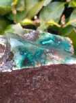
Details: Here is the posting from the California Bureau of Land Management website (please visit the website for rules on collecting): "The Turtle Mountain Wilderness and surrounding areas have long been known for it's beautiful rocks, good jasper, opalite, and much more. Each rain seems to uncover something new. Three proven locales are Mohawk Spring, Mopah Peaks, and Negro Peak. In addition chalcedony rose and agate can be found on either side of Turtle Mountain Road."
Directions: Southwest of Needles including Turtle Mountain Road and surrounding area. View the terrain map in the google map.
 Now On eBay(View More) Now On eBay(View More) | ||||||||||||||||||||
|
|
| ||||||||||||||||||
GPS Coordinates (lat,long): ( 34°28'6.21"N, 114°48'51.58"W)
or (34.468391, -114.814327)
Google Map: (The GPS marker is intended to be approximate or best guess.)
Mindat Link: http://www.mindat.org/loc-27393.html
Tags: needles field office california mowawk spring turtle mountain road mopah peaks negro peak chalcedony rose agate jasper opalite


