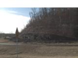
Tahlequah road cut near Illinois River
Uploaded By Scott (webmaster) Uploaded on Tuesday, September 8, 2009 at 02:17:03 PM Viewed 11802 times |
 ShaleHillsid... |
| This website or the contributor can't guarantee the information here to be accurate or to be up-to-date, although that is the intention for the data. Illegal activity or property damage is not the responsibility of this website, but each visitor is encouraged to review the Rockhound Code of Ethics. Each website visitor is advised also to consider reference sources listed and outside sources in their research before visiting the location. |
Details: I am going to assume this land is private land. I don't have any information yet about permission to collect here. All that I do know, is that I noticed a lot of shale piled up on the roadside at the intersection of highway 10 and 62 east of Tahlequah, and I found that it contains a lot of pyrite. There are sand dollar shaped pyrites, as well as crystalline concretions and cubes. The material was abundant and the shale was piled so easily for picking, if only I knew about the permission to collect there.
Directions: East of Tahlequah south of the intersection of highway 10 and highway 62 near the Illinois river.
 Now On eBay(View More) Now On eBay(View More) |
GPS Coordinates (lat,long): ( 35°55'33.89"N, 94°55'38.18"W)
or (35.926080, -94.927272)
Google Map: (The GPS marker is supposed to be exact.)
Tags: pyrite concretions cubes crystals embedded in shale
DSCN8476.JPG |
DSCN8477.JPG |
DSCN8528.JPG |


